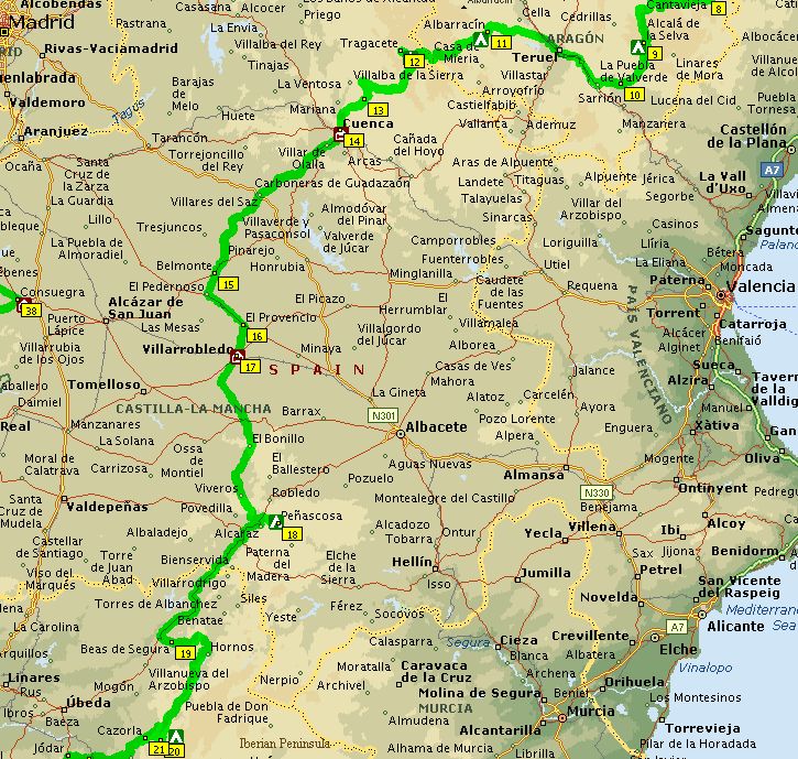
|
 NL
> NL
>
|
Utrecht-Cambrils
(bicycle bus)
 Inspired by
an article in my favorite outdoor magazine Op
Pad and staring in the atlas and road maps
for weeks (months, years?) I've always dreamt
about a cycle trip through the interior of Spain.
At the end of May 1994 I consider it's time to
realize this dream. I book an 'open jaw' bus
ticket from Utrecht to the Costa Brava at the
north-eastern coast and (five weeks later) return
to Holland from Irun near the Spanish/French
border at the Atlantic coast. Although the bus is
equipped with a special trailer for bikes, only a
few cycle tourists show up in Utrecht. Most
people in the bus seem to have planned a sun and
beach vacation, since Salou is a very popular sun
destination for the Dutch. After a long bus ride
we arrive the following morning in Catalunya.
With three other bicyclists I'm dropped off near
a shabby looking hotel along the dusty main
highway. After finding a heavily guarded campsite
in Salou (to my surprise they even speak Dutch at
the office) I cycle north along the coast to
visit Tarragona, a nice town with a few ancient
Roman buildings. Inspired by
an article in my favorite outdoor magazine Op
Pad and staring in the atlas and road maps
for weeks (months, years?) I've always dreamt
about a cycle trip through the interior of Spain.
At the end of May 1994 I consider it's time to
realize this dream. I book an 'open jaw' bus
ticket from Utrecht to the Costa Brava at the
north-eastern coast and (five weeks later) return
to Holland from Irun near the Spanish/French
border at the Atlantic coast. Although the bus is
equipped with a special trailer for bikes, only a
few cycle tourists show up in Utrecht. Most
people in the bus seem to have planned a sun and
beach vacation, since Salou is a very popular sun
destination for the Dutch. After a long bus ride
we arrive the following morning in Catalunya.
With three other bicyclists I'm dropped off near
a shabby looking hotel along the dusty main
highway. After finding a heavily guarded campsite
in Salou (to my surprise they even speak Dutch at
the office) I cycle north along the coast to
visit Tarragona, a nice town with a few ancient
Roman buildings. |
 Salou-Mora d'Ebro-Valderrobres
(130 km) Salou-Mora d'Ebro-Valderrobres
(130 km)
The next day I leave all the beach fun behind and
head for the mountainous inland. It's an
enjoyable ride along small country roads through
the hilly, desolate countryside of El Maestrazgo.
This region is famous for ham and not
surprisingly I pass a lot of pig farms. As usual,
I am not in my greatest shape yet and also the
hot weather (35 C) makes the first stage of the
trip very hard. After a dinner stop at a nice
viewpoint of the Puertos de Beseit, I replenish
my water supply and buy some groceries in
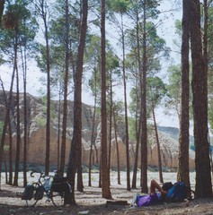
Valderrobres. Just outside of town I find a small
bush along the road where I can pitch my tent for
the night. Puertos de
Beseit
Valderrobles-Morella-Mirambel (95 km)
The road is now climbing steadily until reaching
the Puerto de Torre Miro pass at 1259 m elevation.
After the pass I descend to the beautifully
walled medieval city of Morella, soon followed by
another gem, Mirambel. Here I refill my plastic
water container and a few kilometers down the
road I find a dry river bed where I can pitch my
tent at a nice and quiet spot.
|
CantaviejaMirambel-La Virgen de la
Vega (82 km)
For breakfast I usually make a stop in the very
first town to look for a panaderia (bakery).
In most tiny places I often couldn't distinguish
them from normal houses, though it was not very
difficult to find them. Just ask (even with my
small Spanish vocabulary) or follow people, or
just follow your nose! Another ritual during the
trip is refilling water bottles. Best place to
get agua potable is the local fuente
or tap, often located near the central square
close to the church. During the hottest hours of
the day a mad cycle tourist like me often
attracts a lot of attention from the locals.
Apparently since the recent victories of Indurain,
cycling became very popular in this country. In
almost every town I've been received
enthusiastically by locals. It seems I've made
some progress since the last time I visited Spain.
At the time people cheered Delgado's name, now I'm
Indurain!
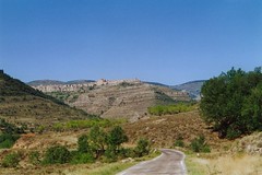
The route remains hilly. Especially the climb
to Cantavieja, a fortified town on top of a hill,
is strenuous, but the views are spectacular and
rewarding. After following the TE 800, climbing
several passes of the Sierra de Gudar (1600-1700
m), I find a small and empty campsite in la
Virgen de la Vega, a desolate ski resort. In the
evening I visit the village of Alcala, which is a
much more lively and attractive place.
|
 La Virgen-Mora de Rublielos-Teruel-Albarracin
(99 km) La Virgen-Mora de Rublielos-Teruel-Albarracin
(99 km)
After Mora de Rublielos a long descent and a busy
highway N-234 brings me in Teruel. Teruel has a
scenic old center, worth a visit. Cycling over
long straight and flat roads, I leave the
bustling city behind. In the distance my next
destination meets the eye: the mountains of
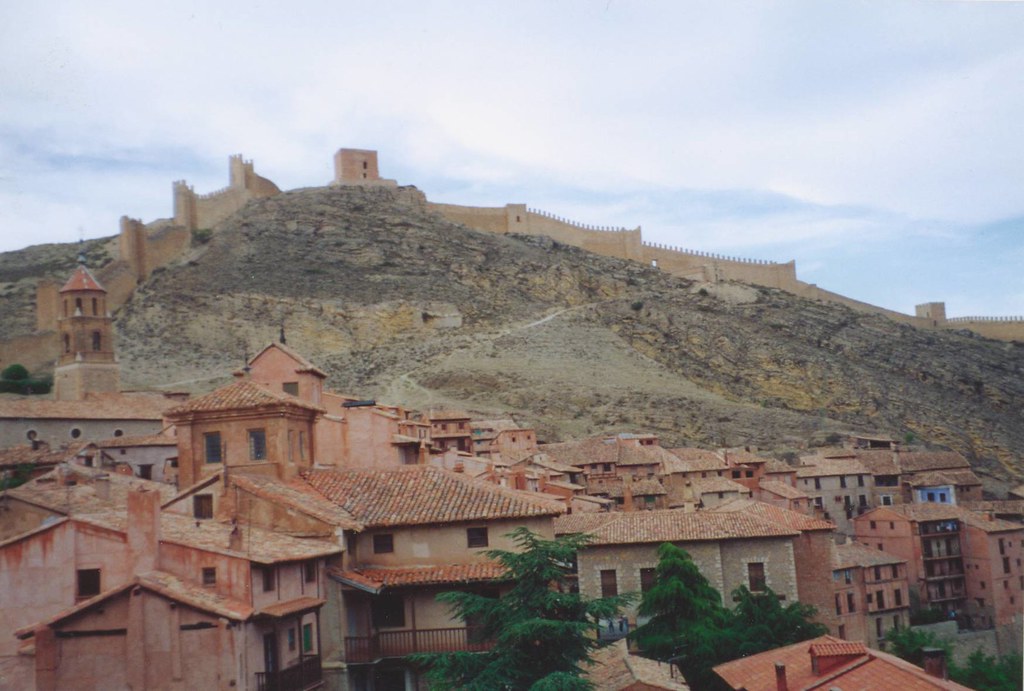
Sierra de Albarracin. The city of Albarracin is
named after a Berber king and is located in an
impressive rugged mountainous landscape. I pitch
my tent at a relatively new campsite in the
outskirts of town. Walking through the city
center I feel like I'm stepping back in time,
like I'm part of a fairy tale of 1001 arabian
nights. The medieval city walls winding over the
hills, reminiscent of the great wall of China and
the beautiful Moorish buildings make a big
impression on me. Luckily this town isn't spoiled
by the mass tourism (yet), even with the
Mediterranean coast and its crowded beaches at
close distance. 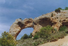 
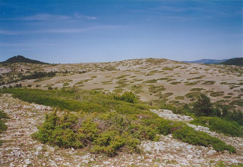
Guadalaviar valley / Montes
Universales
Albarracin-Alto de la Vega (78 km)
 Following the river Guadalaviar
through a narrow gorge I cycle along a valley
with fresh green meadows full of wild flowers,
surrounded by eroded red rocks. The national park
of Montes Universales, higher on the plateau,
consists of bald limestone rocks sparsely covered
with shrubs, which are formed in a strange,
circular pattern. The west side of the mountain
range is called Serrania de Cuenca, the source of
Rio Tajo (Tagus river). This side of the
mountains captures more precipitation and is
densely forested. A few kilometers outside the
village of Tragacete I try to find a zona
acampada. It is shown on the Michelin map on
top of the Alto de la Vega pass. However, after a
short but steep climb (some parts 10% or even
more) I find only a picnic area without water.
Luckily a few kilometers down I find another spot,
including fresh water from the tap and lush green
meadows, a much better place to camp! Following the river Guadalaviar
through a narrow gorge I cycle along a valley
with fresh green meadows full of wild flowers,
surrounded by eroded red rocks. The national park
of Montes Universales, higher on the plateau,
consists of bald limestone rocks sparsely covered
with shrubs, which are formed in a strange,
circular pattern. The west side of the mountain
range is called Serrania de Cuenca, the source of
Rio Tajo (Tagus river). This side of the
mountains captures more precipitation and is
densely forested. A few kilometers outside the
village of Tragacete I try to find a zona
acampada. It is shown on the Michelin map on
top of the Alto de la Vega pass. However, after a
short but steep climb (some parts 10% or even
more) I find only a picnic area without water.
Luckily a few kilometers down I find another spot,
including fresh water from the tap and lush green
meadows, a much better place to camp!
|
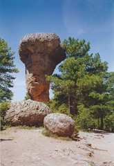
Ciudad EncantadaAlto de la Vega-Cuenca
(99 km)
After some back tracking to Tragacete I head to
the dam of La Toba lake. Near the lake a small
back road climbs to a plateau where another
wonder of nature can be visited: La Ciudad
Encantada, the 'enchanted city'. This part of the
limestone plateau has eroded into weird shapes of
mushroom like rock sculptures. Of course it's a
famous tourist trap and you've to pay an entrance
fee, but it is worth a visit anyway. A quick
descent brings me in Cuenca. The old and scenic
town center is built high above a narrow canyon.
Although it's early June, the temperatures have
risen to unbearable levels (42 C). I decide to
book a hostel in town instead of cycling back to
the campsite, a few kilometers outside of town
and still closed during the siesta.
|
Cuenca-Villarrobledo (154 km)
It's not easy to find the right way out of this
crowded and busy city but finally I'm on my way
on the wide and not too busy N-420 highway,
heading south to the relatively flat La Mancha
region. It is a nice change cycling downhill with
a tail wind at high speed, after all those
strenuous small mountain roads. And every 10 km
or so there are nice gas stations to fill up gas
(=agua y cola). Belmonte has strikingly
white houses and a castle on top of a hill. After
las Pedroneras and El Provincio I finally reach
Villarrobledo, where I stay in a very luxurious
looking (but in fact rather inexpensive) hotel.
Villarobledo-Peñascosa (91 km)
When I wake up I'm glad I've had a roof above my
head, because that night there was a severe
thunderstorm. But when I try to open the tap,
there's no running water! Apparently the
thunderstorm caused some problems. There's even
no electricity to make coffee. Sigh, wish I had
just gone camping! Back on the road, the
landscape reminds me often of Tuscany, rolling
hills of farmland, a few lonesome trees here and
there. Just before the next mountain range,
Sierra de Alcaraz, I pitch my tent in a campsite
near Peñascosa.
Peñascosa-Puente de las Herrerias (161 km)
Although tempting, I decide not to take the
mountainous road through Sierra de Alcaraz, but
choose the faster and easier main highway through
the valley. The part preceding la Puerta de
Segura (70 km beyond) is indeed very fast and
easy. With a tail wind I manage to keep my speed
between 30-40 km/hr! When I take a left turn to
the Sierra de Cazorla it's uphill and slowing
down again. The landscape changes again, with
remarkable green coniferous forests. Along the
road is a beautiful view on the village of Hornos,
situated like an eagle's nest on top of a rock.
For the first time on this trip I meet four other
cycle tourists! They're also from Holland,
started from Malaga and now glad to ride through
a 'normal' forest after having cycled for days
and days between olive trees. Too bad the
campsite just past Cottorios is still closed,
which means another climb to the next campground
in Puente de las Herrerias, 10 km further.
|
 Puente de las Herrerias-
Huelma (104 km) Puente de las Herrerias-
Huelma (104 km)
From the campsite it's only a short climb to the
top of the Puerto de las Palomas pass (1290 m).
On the other side of the pass lies a totally
different landscape. In the distance the white
villages of Burunchel and Iruela and as far as
the eye can see a yellow white sea of rolling
hills, lots and lots of olive trees! This is the
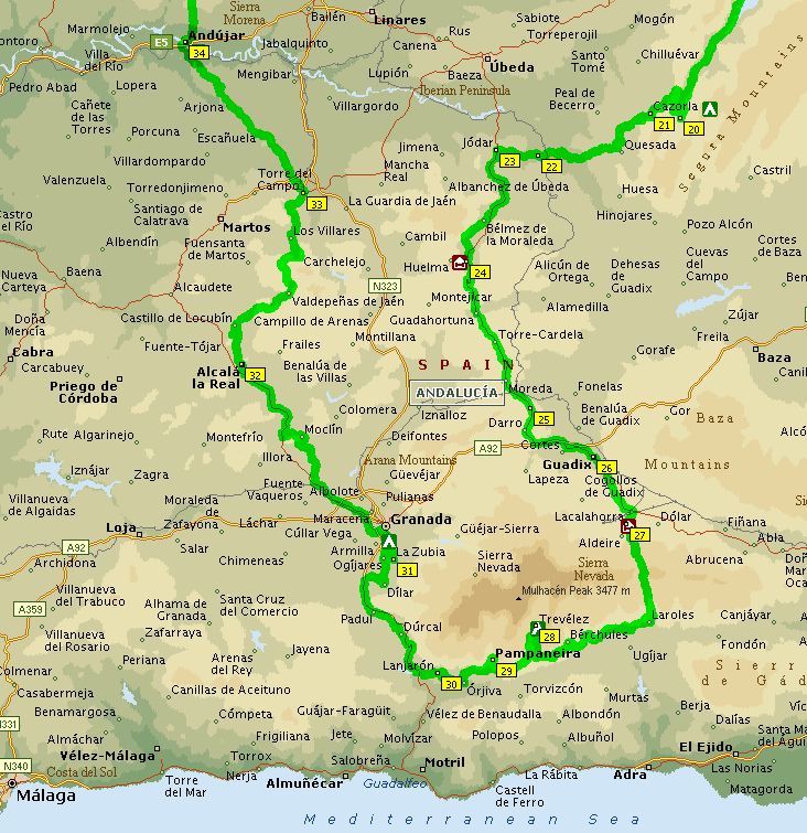
real Andalucia! |
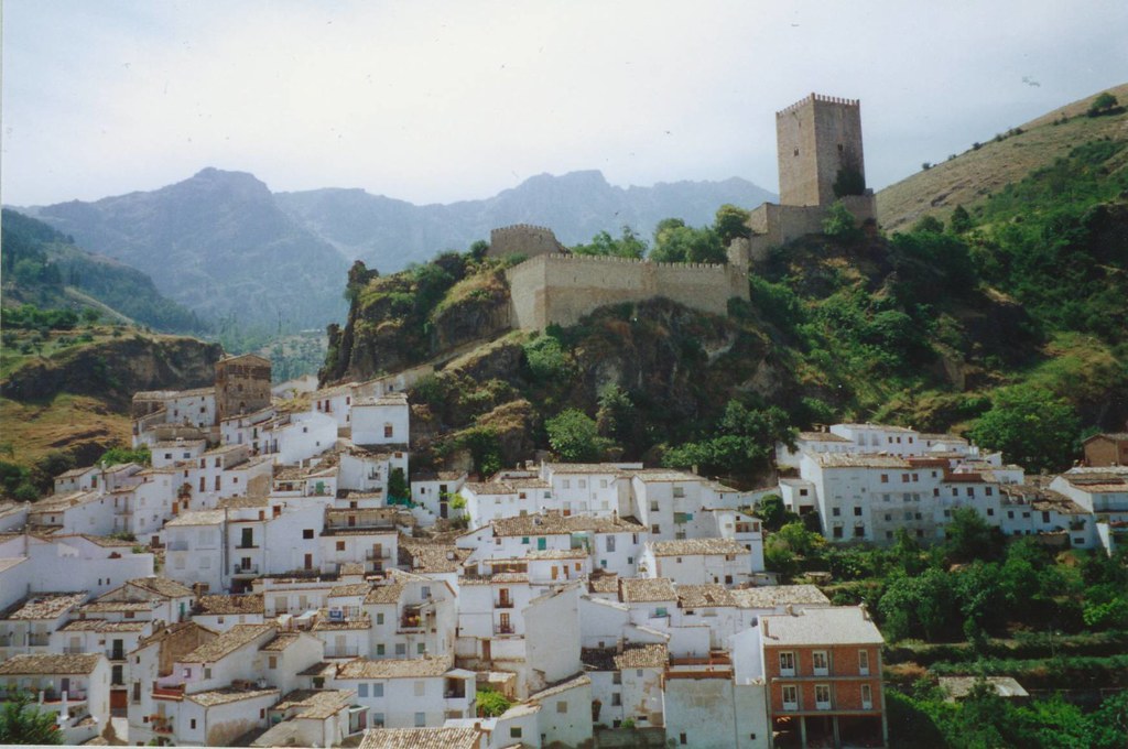
 Cazorla, after a
long downhill, is a very nice busy little town
with an indoor market in Moorish style. Too bad I
cannot find a Michelin road map of southern Spain,
so I've to use my RV/Euroatlas until Granada.
Although its scale (1:300,000) is larger than the
Michelin maps (1:400,000), the latter is more
accurate and reliable. On the RV maps the quality
of the roads are badly marked. For instance the C-328
road between Cazorla and Jodar looks like a major
highway on the RV map, but in fact it turned out
to be a very narrow and a poorly paved, bumpy
road. Cazorla, after a
long downhill, is a very nice busy little town
with an indoor market in Moorish style. Too bad I
cannot find a Michelin road map of southern Spain,
so I've to use my RV/Euroatlas until Granada.
Although its scale (1:300,000) is larger than the
Michelin maps (1:400,000), the latter is more
accurate and reliable. On the RV maps the quality
of the roads are badly marked. For instance the C-328
road between Cazorla and Jodar looks like a major
highway on the RV map, but in fact it turned out
to be a very narrow and a poorly paved, bumpy
road. After the turnoff to Jodar (C-325)
the road is remarkably better improved. However,
the suffering is not yet over, because of the
strong head winds and the heat. Although the road
improvements result in a smoother surface and
wider road, not all the reconstructions are
beneficial for cyclists. Especially when hills
are encountered, the old winding road makes the
climb easier than the straight and short (which
means steeper) new road. Also the many trees
along the road, which provide some shade, have
been removed. Anyway, after the hard labor
I find a comfortable and inexpensive hostal in
Huelma (2600 Pts including dinner and breakfast).
Until so far the best I've had on my trip.
|
 Huelma-La Calahorra (91 km) Huelma-La Calahorra (91 km)
I continue my route heading to Guadix on the N325.
Until Guadahortuna there are some reconstructions
of the highway, but most of the highway is
remarkably narrow and quiet. The landscape is now
very dry, consisting of badlands in a semi-desert
like environment.
Near Purullena the narrow two lane highway ends
at the four lane freeway Granada-Guadix,
forbidden for bicyclists! What to do now, the
maps show no alternative! Where the N325 stops, a
small back road descends down into a green
forested valley, but this road isn't shown on the
map and I have no idea where this road is heading
to.
I decide to follow the old highway, but after a
mile or so it bends from the freeway and ends at
a gravel pit. Following the sand lorries over
bumpy gravel roads, I'm finally back on the busy
freeway. Since there's no other alternative to
get to Purrullena I continue trespassing the law
and risking my life.
In Purrullena and Guadix cave dwellings can be
found: white buildings, carved in the soft
volcanic tuff bedrock. It's a funny sight seeing
all those television antennas and chimneys rising
like plants out of the earth. I spend the night
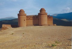
in a hostal in Lacalahorra, situated on the
foothills of the Sierra Nevada mountains. The
village is dominated by an medieval castle on top
of a hill. In the evening I stroll up this hill,
watching the sunset and enjoying a wonderful view
of the surrounding plains.
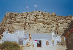  
Cave dwelling in Guadix (l),
Lacallahorra (r)
|
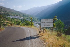 Lacalahorra-Trevelez
(82 km) Lacalahorra-Trevelez
(82 km)
The next morning a difficult task is waiting for
me. A long climb over the Puerto de la Ragua, with 2,000
meters elevation one of highest paved mountain
passes in Spain. Luckily the 12 km climb turns
out to be very gradual and not steep at all. The
first winding kilometers I'm enjoying the
excellent views on Lacalahorra and surroundings.
On top of the pass the temperatures are 20 C,
cool and refreshing! My strains are rewarded by a
nice descent which brings me now in the
Alpujarras. Probably one of the most scenic roads
of Spain is the GR 421 from Lanjaron to Trevelez.
I cycle along lush semi-tropical vegetation and
picturesque white Moorish villages. On the narrow,
winding road, accompanied by the sound of birds,
murmuring water streams of irrigation channels
and splendid views of the rugged mountain scenery,
cycling here is absolutely a feast. I meet a lot
of other local cyclists, training or touring in
large groups on mountain bikes. Trevelez,
which claims to be the highest village of Spain (1700
m), is covered in a dense fog. Since my body is
used to the heat, it suddenly feels if it's
freezing cold! I pitch my tent on the local
campground and spend some time sight-seeing. The
village is built on the steep slopes and is
divided in three different levels. As everywhere
in Spain this town has also its fiesta, with a
lot of music, food stands and fireworks!

Altitude graph Lacallahorra-Trevelez-Granada
|
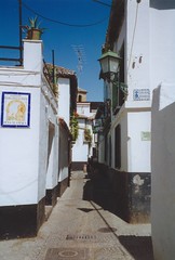 Street in
Moorish district
Trevelez-Granada (90 km)
Heading west to Orjiva, I continue cycling the
scenic road through the Alpujarras. Especially
the view of 'white' villages Pampaneira, Bubion
and Capileira is hauntingly beautiful. From
Capileira an unpaved mountain road is leading to
the Pico Veleta, the highest paved mountain road
in Europe (3398 m). On the other side it descends
to Granada, my destination for today...The very
tough climb is tempting, but the climb is unpaved
and I wonder if the climb is feasible with my
Giant touring bike. Besides, the mountains are
covered in clouds, so I doubt if it's all worth
the effort.
Finally I decide to get to Granada via Lanjaron
and the less difficult Puerto del Suspiro del
Moro pass. The heat and the heavy traffic makes
the climb more difficult than I thought. Along
busy roads I arrive in the smoggy city of Granada,
where I find a nice campground in the suburb of
Zubia. Here I meet again other cycle tourists. A
Swiss couple just arrived from the Pico Veleta.
They've done the climb from Capileira from the
south side and have made a great trip! Although
they were on mountain bikes, it seemed not
impossible with a touring bike. Guess I'd made a
wrong decision... :-(
|
 Granada (rest day) Granada (rest day)
Since I'm half way of my trip and little
exhausted by the heat and mountainous terrain, I've
no courage and motivation to tackle the 40 km
long climb to Pico Veleta today, even this would
mean an altitude record. Granada itself is a very
interesting city to spend the whole day sight
seeing though. The Moorish district Albaicin and
of course the famous palace of Alhambra with the
beautiful gardens of Generalife are certainly
worth a visit.Granada: view
on Alhambra
|
| I am still considering to cover
one leg of the trip (Granada-Madrid) by train. At
the RENFE railroad station I gather some
information for trains heading north. The
situation seems quite complicated and nobody
speaks English. It seems that the only train
which carries bikes runs at night. Since I've
covered the first part of my trip on scheme, I
decide to cycle the whole way to Toledo (about
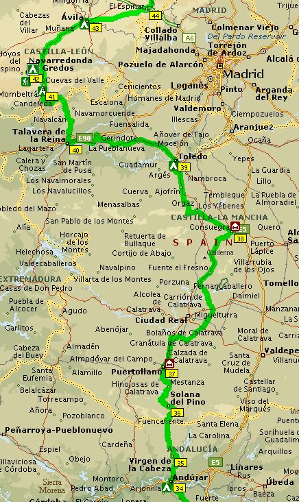
475 km) without cheating. Granada-Andujar
(154 km)
The next morning I meet two other Dutch guys at
the campground. They've the same Vaude tent as me
and another remarkable co-incidence is that they've
also cycled two weeks to get to Granada, more or
less via the same route, they only covered more
km's starting at the Spanish/French border! And
just like me, they are heading to the north coast
as well, taking the bus back from Hendaye, in
Southern France. They only have less time, so
probably need to do some 'cheating' by taking
busses or trains.
A few hours later I leave Granada behind,
cycling on the (for cyclists forbidden!) freeway.
Since there's no other alternative, I'm again
breaking the law...;-) The first 100 km until
Jaen flies by very fast. The next 50 km are tough,
rolling hills of farmland and olive trees,
providing no shade, high temperatures (35-40 C)
and melting asphalt. Exhausted and thoroughly
baked I arrive at a nice and empty campground,
located in the middle of the city center of
Andujar.

Profile Granada-Andújar-Puertollano
 Andujar-Puertollano
(131 km) Andujar-Puertollano
(131 km)
My map tells me that the next part is going
through a very desolate region. Between Andujar
and the next village almost 80 kilometers nothing
but farmland. Considering the heat I take another
extra water bottle. Luckily it's a cloudy day
with not too much sunshine and it's even
drizzling a little bit for the first time!
The first leg of the trip to the sanctuary of
Virgen de la Cabeza I'm accompanied by two local
riders on fancy racing bikes. The smooth paved
road turns into a bumpy narrow climb and I beat
one of the riders on my fully packed bicycle. On
top of the climb the two riders return back to
town.
After visiting the monastery (the last change of
getting supplies) I head north into the desolate
region of the Sierra Morena. Cycling on a traffic
free narrow road along nicely smelling herbs and
shrubs, brings back sweet memories of former
trips in the French Provence and Corsica.
Andalucia lies now behind me and I'm again in the
district of Castilla-La Mancha. The Sierra
Madrona mountains are covered with green forests
with protruding bare red rocks. A difficult
narrow and winding mountain road is climbing to a
pass of 980 m elevation. A few hundred meters
below the rim a back road is leading to the
mountain village Solana del Pino. Supposing this
is the most easiest way, I'm heading down to the
village. But after the village the road climbs
again and even steeper than before. The last
meters are even too steep and for the first time
I've to push the bike. Just beyond the actual
pass the ruta fatigosa joins the main road.
After a long descent I'm back again in the hot
valleys with rolling hills and olive trees and no
shade. In the busy city of Puertollano I book a
room in a hostel.
|
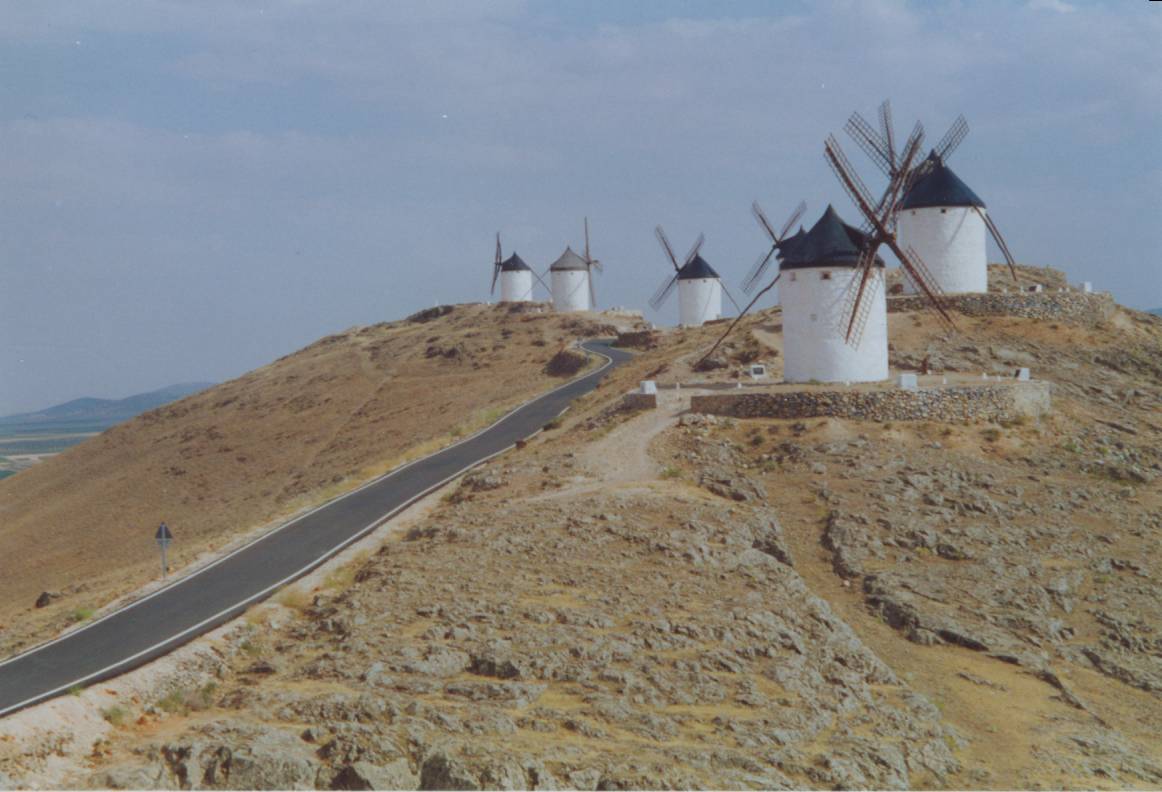
 Puertollano-Consuegra (121 km) Puertollano-Consuegra (121 km)
After cycling the not-so-busy highway to Ciudad
Real I follow a back road near the national park
Tablas de Daimiel. This park, consisting of
wetlands, is now suffering from long periods of
drought. The rivers shown on the map are actually
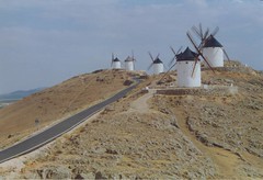
nothing but dry river beds. Past Urda the white
windmills of Don Quixote are visible from way in
the distance, an impressive sight. Consuegra,
dominated by a hill on which a dozen windmills
and a ruin can be visited, seems a very
attractive place to stay.
Windmills of Consuegra
|
Consuegra-Toledo (75 km)
Short ride to Toledo. Via Mora and the ruin of
Almonacid I arrive in the early afternoon in
Toledo. Approaching the outskirts of town my
first impression is that's it's just another city.
But when I'm climbing out of the narrow gorge of
the river Tagus, the majestic panorama of the
Toledo's skyline is revealing. Riding on the
skyline road is like being spectator in a movie.
Campground 'El Greco', on the other side of town,
is filled with people. Although a lot of them are
also Dutch, unfortunately I meet no other
bicyclists. The afternoon I spend exploring the
inner city, nice though crowded with tourists.
Toledo-Mombeltran (123 km)
Highway 502 follows the Tagus river for a while,
then bends into rolling hills. After La Puebla
long straight roads are leading to Talavera, the
center of the ceramic industry. Approaching from
the south, the sight on the vast wall of the
Gredos mountains, rising high (almost 2000 m)
above the low plains of the Tietar valley, is
very impressive.
On the foothills just before Mombeltran, I find a
nice campground. Most of the campgrounds in Spain
have nice, clean and modern facilities. The rest
rooms make almost a luxurious impression compared
with most of the French camping municipal.
|
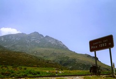
Puerto del Pico
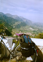
Mombeltran-Navarredonda de Gredos (75 km)
From the very first meters I've to conquer an
elevation difference of 700 m. The 12 km long
climb over Puerto del Pico (1352 m) is
not too bad, however. It is just a very nice
climb, constantly winding and twisting, every
time another beautiful view over the Tietar
valley. On the other side of the pass the road
stays more or less on the same high altitude,
going through alpine meadows. Near San Martin del
Pimpollar I turn left into a valley. From here,
on the north side slope, the peaks of the Gredos
mountains are still covered with snow, even in
this hot summer!
On one of the (dead ending) mountain roads I find
a beautifully located campground in the forest.
Here I pitch my tent and leave my luggage,
heading for the snow capped mountains in the
distance.
On 1,750 m elevation the pavement ends and a
small rocky trail continues from the parking lot.
After some hiking through alpine meadows I return
to the campground.
|
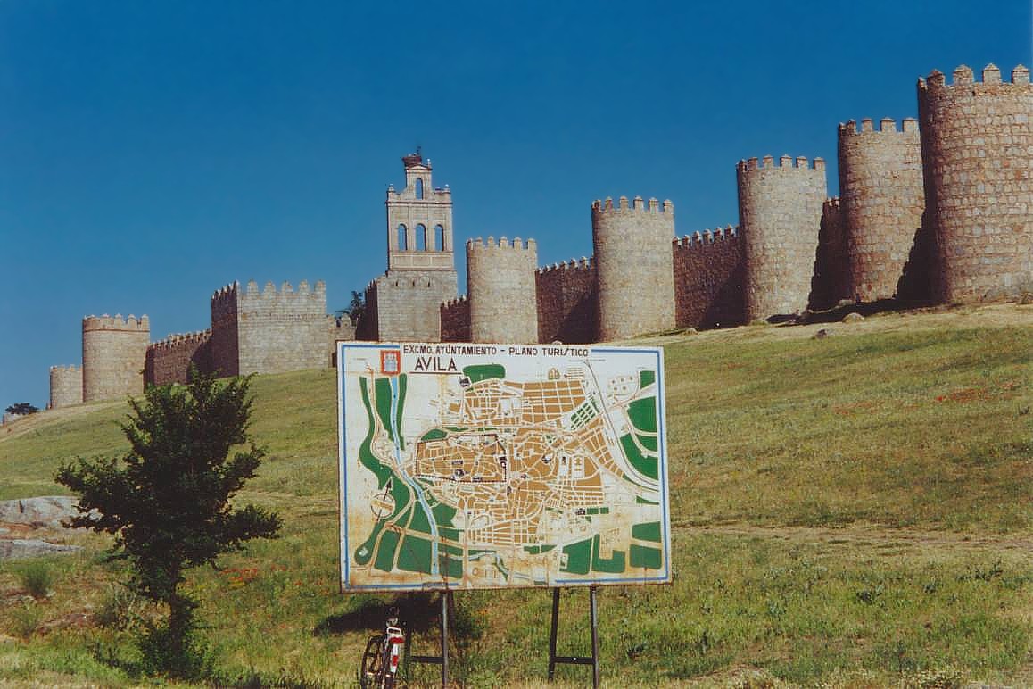
Sierra de Gredos-Avila (81 km)

Short stage to Avila (elevation 1,100 m), the
highest located provincial capital in Spain. The
mountain scenery along the highway consists of
green alpine meadows. I've always wanted to visit
this town, inspired by the television broadcasts
of the impressive arrival in the Vuelta d'
España (Tour of Spain). In the
afternoon I've still plenty of time to visit the
inner city, walking distance from the campground.
The city center is enclosed by an impressive,
well preserved medieval city wall. Personally, I
like this town more than the tourist trap of
Toledo, it has more ambience and fewer tourists.
Avila
 Avila-Segovia
(89 km) Avila-Segovia
(89 km)
Another short stage to the next historical
highlight, Segovia. Instead of taking the direct
route to Segovia (highway N-110) I take a back
road to El Espinar. Like most of the 'white'
roads on the Michelin map this is not a bad
decision. After the hamlet of Bernuy-Salinero the
road leads through a desolate landscape full of
alpine meadows. Beyond El Espinar I descend on a
wide two lane highway, followed by small country
roads near the Riofrio palace. Arriving in
Segovia, home town of the famous rider Pedro
Delgado. His name is frequently written on the
road and I meet a lot of cyclists training on
racing bikes. As usual the last couple of days, I
spend the afternoon sight-seeing. Lots of things
to see, like the impressive aqueduct, the walled
inner city with cathedral and the Alcazar castle.
Segovia-Aranda de Duero (131 km)
On the campground I'm repairing for the third
time a flat tire. My rear Continental touring
tire is after 6,000 km totally worn out! In a
cycling minded city as Segovia it's easy to find
a good bike shop where I buy a new touring tire.
From Segovia I head north to Aranda de Duero. The
farther north I go, the greener the landscape.
Near Cantalejo I cycle on traffic free back roads.
The asymmetrical ridges here are called cuestas,
hills with a long gentle slope on one side and a
sharp, steep face on the other side. In Aranda
the visitor center directs me to a campground 5
km outside of town. The cheap camping municipal
is nothing more than an empty meadow behind the
swimming pool. Rest rooms and a (cold) shower are
at the swimming pool.
|
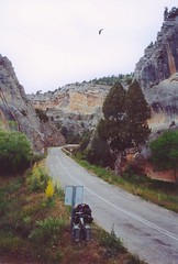 Gorge of the
Yecla
Aranda de Duero-Quintanar de la Sierra (91
km)
Beautiful ride through the limestone Peñas de
Cervera mountains. I wonder what all those busses
loaded with tourists are doing at the monastery
of Santo Domingo de Silos. Later I find out that
the monks are very popular in the music charts
everywhere in Europe. Near the monastery I follow
the spectacular narrow gorge of the Yecla river.
Until Sales de los Infantes I'm cycling through a
landscape of impressive folded limestone rock
formations. The camping municipal in Quintanar is
not yet opened for the season. Because of the
rainy and cool weather I decide to book a room in
hostal 'Domingo'.
Quintanar-Najera (121 km)
Until so far the next mountain range of Sierra de
la Demanda disappoints me a bit (or is it just
the fact that I'm a bit saturated?). On a
crossroad not shown on the map I take the wrong
turn, leading to Laguna Negra on 1,900 m.
elevation. Because of the dense fog I can't enjoy
the landscape. At the turn off to Neila I can
take a short cut to Villavelayo, 12 km less than
the main route.
According to a passing hiker, the shortcut is not
recommended due to the bad quality of the roads,
so I decide to stay on the main road heading to
Huerta de Arriba. After the descent I discover
too late I've missed the turn and find myself in
Huerta Abajo (low) instead of Huerta Arriba (high).
Instead of returning and climbing back, I
continue the descent going west and then head
back east through another valley, another detour
of 25 km.
Despite all those detours and the rainy and cool
weather (10-15 C!) the ride is becoming more
enjoyable and the landscape of the rugged
Najerilla valley spectacular.
Finally, after frequently seeking shelter for the
rain and thunderstorms (in a bar, a shepherds'
shed and a small overhanging cliff) the weather
is clearing up again when I arrive in Najera. The
campground is at walking distance of the city
center, where in the evening a fiesta is being
held, with live music until early in the morning.

Profile S. de Gredos -
Najera
|
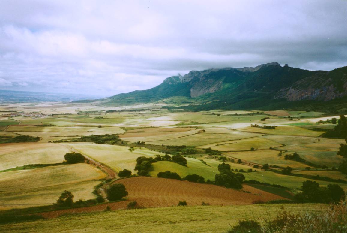
 Najera-Alsasua (113 km) Najera-Alsasua (113 km)
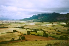
Crossing the Ebro river, I'm facing the next
obstruction: the Sierra de Cantabria mountains
rising high above the Rioja hills and valleys (photo).
This region is famous for its wine. Passing
little picturesque villages like Laguardia and
Cripan the road gradually emerge from the valley.
Past Lapoblacion the road follows the ridge, with
awesome views on both sides of the crest. The
valleys on the other (north) side of the
mountains always seems greener than on the other
(south) side. I'm now in Basque Country. The
green hills and bare limestone rocks are
reminding me of the Jura mountains in Switzerland.
After the descent from the Puerto Opacua pass I've
to take the very busy N1 highway to Alsasua. Rioja valley
|
 Alsasua-Hondaribbia
(130 km) Alsasua-Hondaribbia
(130 km)
It's not fun riding on the main freeway to
Pamplona. I decide to leave the crowded highway
as soon as possible. A small mountain road from
Uhuarte Arakil to the monastery San Migel de Aralar seems a
good alternative. However, the map did not tell
me how terrible steep the climb was... On some
parts I'm zig-zagging trying to hold my pace on
the 15% steep slopes. A whole bunch of vultures
sits high in a tree and circle above the road.
They are patiently waiting until the huffing and
puffing cyclist finally collapses.... Too bad for
them, I make it alive to the monastery on 1,235 m.
elevation. Here I treat myself to ice cream and
enjoy the views of the Arakil valley.After
descending to Lekunberri and the narrow valley of
the Urumea, I finally reach the coastal plains,
cycling for the first time during my trip on a
bike path in Oyarzun. The last kilometers until
Irun are dominated by Monte Jaizkibel, a well
known climb in the classic bicycle race San
Sebastian-San Sebastian. On the foothills of the
climb I find a campsite in the seaside resort
Hondaribbia.
Hondaribbia-San Sebastian-Hondaribbia (73
km)
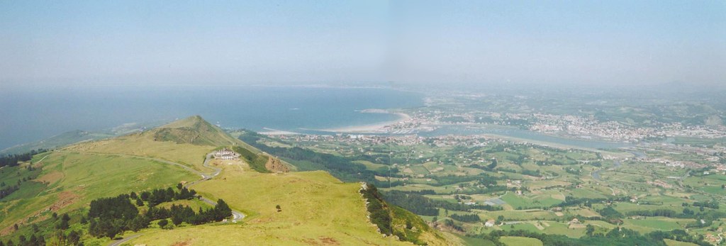
The last day of the trip I treat myself with a
climb on Monte Jaizkibel (448 m).
Leaving my luggage on the campground, this climb
is a piece of cake and a really dessert of the
trip. Marvelous views on the Bay of Biscay and
the interior. On the other side of the climb I
visit the picturesque fishing town of Pasaia
Donibane, consisting of only one narrow street.
Taking the awful 4-lane highways I arrive in San
Sebastian, a pretty bustling city, situated along
a scenic bay.

Heading back to the campground I can't resist
cycling once again over Monte Jaizkibel. On top
of the mountain I leave my bike behind and hike
up a small trail. I spend a few hours on the rim,
taking pictures and enjoying the views. After the
first clouds arrive from the seaside, the whole
mountain is soon covered in dense fog. Time to go
back to the campground. One hour later the
weather has changed completely, heavy overcast
and a strong breeze. A very symbolic end of my
trip. After thirty days and 3,018 kilometers on
Spanish roads I pack up my tent for the last time
and cycle the last 5 kilometers to Irun, where I
board the bus back to Holland.
|
|
|
|