Tuesday July 18, Moab-Fruita (96mi/154
km)
Leaving Moab, I cycled along the Colorado
river through a very scenic canyon. On the
river a lot of people were rafting. The
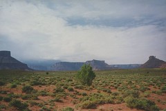
landscape along highway 128 was almost as
fantastic as I'd seen in Monument Valley.
About 30 miles from Moab I left the canyon
and entered a landscape consisting of rolling
hills and prairies. When I entered Cisco,
half way the trip, I thought I could refill
my bottles somewhere. Wrong, Cisco was a
ghost town! All the buildings seemed to be
deserted. Luckily there were some people busy
with road constructions. After refilling my
bottles I headed for the next part over the
freeway to Colorado. It was allowed to cycle
on the freeway, because there were hardly any
other alternatives from Moab to Grand
Junction.
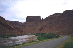
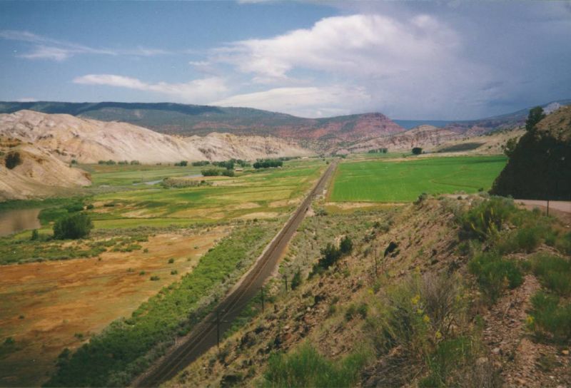
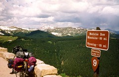
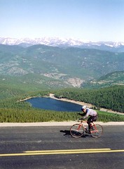
Colorado valley
 The only other
alternative was the dirt trail along the
Colorado River. This so called Kokopelli
trail is 120 miles long and without a
mountain bike, a good map and plenty of water
and food not recommended, certainly not one
day.
The only other
alternative was the dirt trail along the
Colorado River. This so called Kokopelli
trail is 120 miles long and without a
mountain bike, a good map and plenty of water
and food not recommended, certainly not one
day.
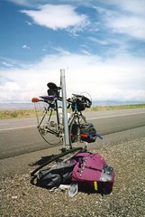
The ride along the freeway was not too
bad, except for my first flat tire of the
trip. The four lanes had wide shoulders and
there was hardly any traffic. After a long
day ride and more than 90 miles from Moab I
arrived back into civilization. In a small
village of Fruita, near Grand Junction, I
pitched my tent at an expensive RV campground.
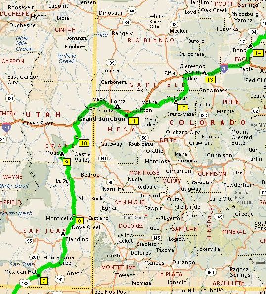
Wednesday July 19, Fruita-Lake Vega
(77mi/124 km)
With a just bought detailed state map of
Colorado I'd find my way over small back
roads along lots of orchards, leading me
around Grand Junction. When I'd wanted to pay
for some peaches at one of the fruit stands,
they offered it for free! At the turn-off to
Colbran, I'd finally left the freeway. The
narrow paved road was going through green
meadows and farmland, reminding me of the
Ardennes in Belgium or the Black forest in
Germany. I ended the day at a primitive
campground at Lake Vega.
Thursday July 20: Lake Vega-Glenwood
Springs (63mi/102 km)
Riding on the mountainous gravel roads I
hardly met other traffic and enjoyed viewing
the wild life. At the end of the day I
descended down to the Colorado valley, the
last part to Glenwood Springs I had to cycle
again over the freeway. Glenwood Springs is a
busy tourist resort town. In the distance the
snow capped Rockies were already visible.
Friday July 21: Glenwood Springs -State
Bridge (68mi/110 km)
From Glenwood Springs I followed the
narrow Glenwood canyon, there was even a bike
path along the freeway and the river! For the
first time since Monument Valley I
encountered two other bicycle tourists. One
American girl, making a bicycle tour through
Colorado, had already met a few other Dutch
cyclists on her trip!
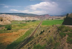
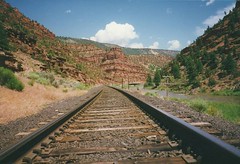
After 15 miles from Glenwood the freeway
diverted from the river, but I'd decided to
follow the Colorado, taking a narrow gravel
road along the river and railroad. Although
very remote, it was a quite scenic ride,
which seemed also popular amongst other
bicyclists. The villages shown on the map
were often nothing more but a few farms. When
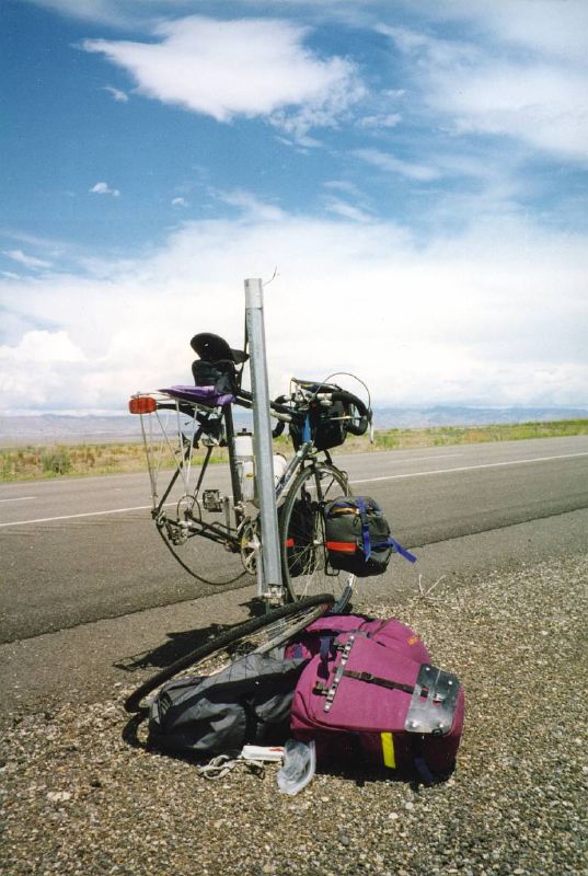
I got to the hamlet of State Bridge, my fuel
was empty, I forgot to get enough supplies in
Glenwood Springs!
In the pouring rain I pitched my tent
between the woods close to a lodge/restaurant,
where I could use the shower for a few bucks.
Seeking shelter from the rain, I enjoyed a
good meal and live music in the restaurant.
Saturday July 22: State Bridge -Lake
Granby (64mi/103 km)
 The
restaurant was still closed in the morning,
and I hadn't bought enough bread for
breakfast and the (difficult) ride to the
next town, Kremmling. Luckily the owner of
the lodge gave me some donuts and a few miles
further down the road I could make another
breakfast stop at a holiday farm. I was set
for the 30 miles dirt road to Kremmling. It
was quite frustrating ride up and down. I
still wonder why this road wasn't built along
the railroad, following the Colorado river
closely. The landscape was very scenic
though, this part with snow capped Rocky
mountains in the distance, reminded me a lot
of the mountains of Jotunheimen, Norway.
The
restaurant was still closed in the morning,
and I hadn't bought enough bread for
breakfast and the (difficult) ride to the
next town, Kremmling. Luckily the owner of
the lodge gave me some donuts and a few miles
further down the road I could make another
breakfast stop at a holiday farm. I was set
for the 30 miles dirt road to Kremmling. It
was quite frustrating ride up and down. I
still wonder why this road wasn't built along
the railroad, following the Colorado river
closely. The landscape was very scenic
though, this part with snow capped Rocky
mountains in the distance, reminded me a lot
of the mountains of Jotunheimen, Norway.
The dirt road ended just before Kremmling,
where I treated myself on a hot meal in a
restaurant.
The next stage to Grand Lake went very fast
and easy compared to the dirt road. I camped
at a national forest campground, as always a
very primitive one with poor sanitary
facilities and without a shower. Because of
the weekend the campground was crowded (possibly
many people from Denver). Many campfires,
barbecue and loud music, a typical American
campground culture. Luckily the campground
was "full", which meant another
free site. I could pitch my tent on a spot
behind some trailers, assigned by the
campground host himself!
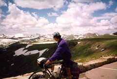
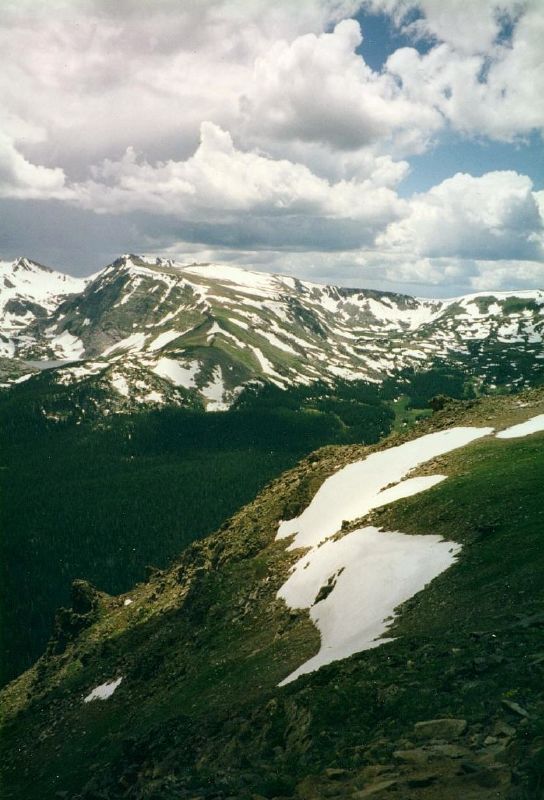
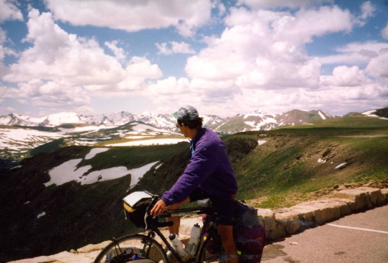
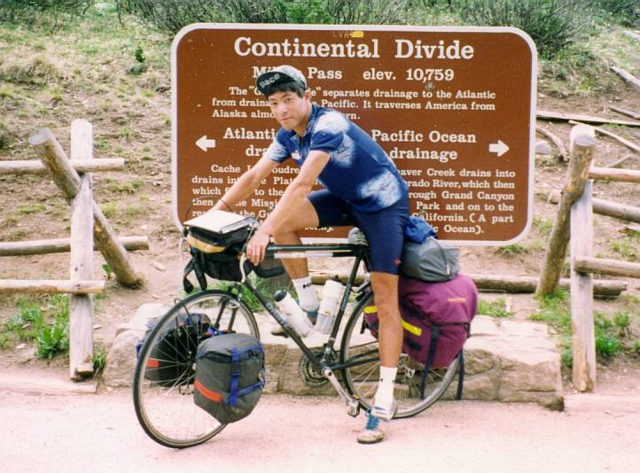
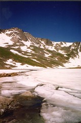
Trail Ridge Road, Rocky
Mountain National park
 Sunday
July 23, Lake Granby -Estes Park (63mi/101 km)
Sunday
July 23, Lake Granby -Estes Park (63mi/101 km)
The whole day was sunny and dry. The climb
through Rocky Mountain National park to the
Milner pass beat my altitude records of the
French Alps: 3,279m! Despite of the
impressive altitudes the climb was not very
hard, since I started at an elevation of 2,400
m. After Milner pass, the road continued
climbing, on Trail Ridge pass I reached the
highest point I'd ever been on bike: 3,713 m
above sealevel! Unfortunately there were no
signs along the road which proved this
highlight. Another bummer were the huge
crowds in the park, finding a traffic jam in
a National Park is not what I expected.
Between the long line of cars I headed down
to Estes Park.

Monday July 24, Estes Park -Idaho
Springs (68mi/110 km)
 After the
highlights I followed the "peak to peak
highway" down south. No big passes
needed to be climbed, but the highway is
built across the valleys, which meant
climbing up and down several times. I felt
that this day was tougher than the long climb
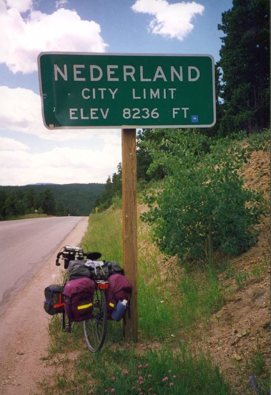
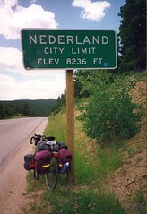
to Trail Ridge road. Half way I entered the
village of ......Nederland! It was weird to
be in a place named after my own country in a
mountainous landscape like the Rockies. Of
course I bought a couple of postcards:
Greetings from Nederland, funny!
After the
highlights I followed the "peak to peak
highway" down south. No big passes
needed to be climbed, but the highway is
built across the valleys, which meant
climbing up and down several times. I felt
that this day was tougher than the long climb
to Trail Ridge road. Half way I entered the
village of ......Nederland! It was weird to
be in a place named after my own country in a
mountainous landscape like the Rockies. Of
course I bought a couple of postcards:
Greetings from Nederland, funny!
After a long descent I arrived in a small
town crowded with bus loads of tourists.
Black Hawk/Century City seemed to be gambling
towns with lots of casino's. Resisting the
gambling fever, I cycled the though climb
uphill. On top of the hill I'd followed a
gravel road along a few abandoned gold mines
and finally arrived in Idaho Springs. Since
there were no campsites, I stayed into a
motel, which was nice for a change.
Tuesday July 25, Idaho Springs -Denver
(99mi/160 km)
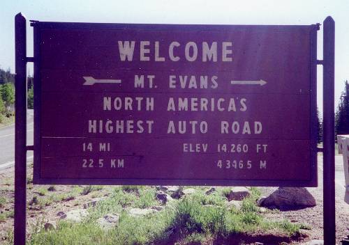
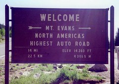 The snow capped
peak of Mount Evans (4,346 m) rose high above
the valley. The highest paved road climb in
North America leaded to the top of this
mountain. Of course I couldn't resist the
challenge beating another all time high
altitude record! Since I was planning to head
for Denver afterwards, I headed with a fully
loaded bike (!) up the mountain. The road
gradually climbed at an average grade of 4%
for 14 miles until reaching Echo Lake (+10,000
feet) so even with all the gear it was not
too bad.
The snow capped
peak of Mount Evans (4,346 m) rose high above
the valley. The highest paved road climb in
North America leaded to the top of this
mountain. Of course I couldn't resist the
challenge beating another all time high
altitude record! Since I was planning to head
for Denver afterwards, I headed with a fully
loaded bike (!) up the mountain. The road
gradually climbed at an average grade of 4%
for 14 miles until reaching Echo Lake (+10,000
feet) so even with all the gear it was not
too bad.
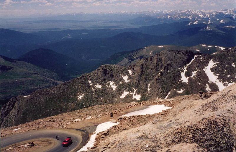
During the climb to Echo Lake
a red van was passing me, every time a girl
got out and chalked encouraging words on the
road surface. They were also taking pictures
of me and cheered me on. I was flattered by
all this attention, but soon as I'd reached
Echo Lake, it became clear that just behind
me another cyclist was trying to tackle the
climb, Greg from Illinois. His supporters
offered their help to carry some of my
luggage in the red sag wagon. After putting
all my luggage in the back of the van, it
felt almost like I had wings uphill. Greg on
his fancy racing bike seemed not too fit and
certainly not adapted to the high altitude
and soon I'd left him behind as if he was
walking.
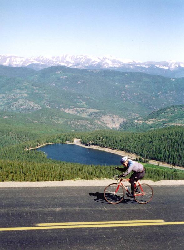
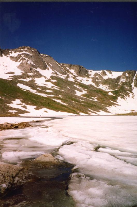
Mount Evans
It was clear I had no problems with the
altitude at all, being in this high regions
for two weeks. Only the very strong winds,
that nearly blew me from the road, were
causing some difficulties. The grade was not
very spectacular either, averaging only 5% or
so. When I got to the summit, after 14
relatively easy miles from Echo Lake, I felt
a bit disappointed that there was absolutely
NO sign which showed the altitude!

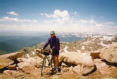
On top of the world!
I left my bike at the parking lot, and
hiked up a short trail to the actual summit.
Greg, who arrived later, even carried his
bike to the top! After a while, more cyclists
arrived at the top. Mount Evans seemed a very
popular destination for cyclists!
After saying good-bye to Greg and his
family, I loaded my luggage onto the bike and
headed quickly down to Denver, still 60 miles
(100 km) to go! Several hours later my
arrival at a campground close to Denver (Chatfield
park) was a bit of a bummer after the great
ride. A large, dreary and empty place,
enclosed by freeways, not very nice. Luckily
I was not the only one on bike. A Japanese
couple, who'd just made a bike trip through
Colorado, camped there also and we exchanged
some experiences.